M2 Blog: M2 Offers a More Complete Picture for Understanding Vessel Risk to Whales
M2 Blog: M2 Offers a More Complete Picture for Understanding Vessel Risk to Whales
Posted by M2 Team
September 21, 2026
How M2 Helped Scientists Get a Clearer Picture of a Busy Waterway
Every day, commercial ships, ferries, recreational boats and other vessels pass through the Golden Gate Strait. At the same time, the area is home to marine mammals that share these waters—including whales, dolphins, porpoises, and California sea lions.
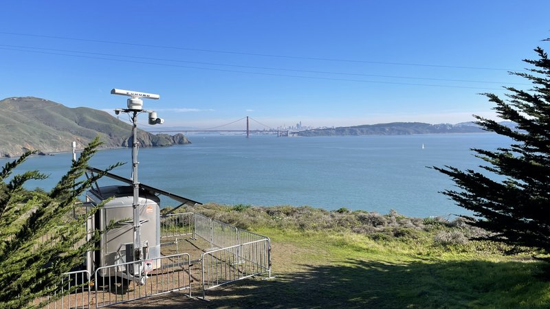
A new study led by researchers at The Marine Mammal Center provides a yearlong look at vessel traffic entering San Francisco Bay. Using the M2 monitoring system positioned at the mouth of the Golden Gate Strait, researchers tracked the types of vessels moving through this busy seaport to better understand potential risks to whales in the bay.
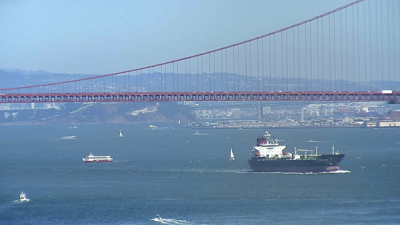
The system uses traditional marine radar to track vessels and collect high-resolution information about their movements. Unlike some vessel tracking systems that primarily capture larger commercial ships, radar can detect vessels of all sizes—including small recreational boats that aren’t required to transmit through the Automatic Identification System (AIS).
By sampling almost 50 days of data, the researchers estimated that 81% of vessels in the area were smaller vessels that were absent in the AIS data commonly used in whale-vessel strike risk assessments. Without the radar system onboard M2, over 3,000 vessel visits to the area would be missing from a traditional vessel dataset from the sampling period.
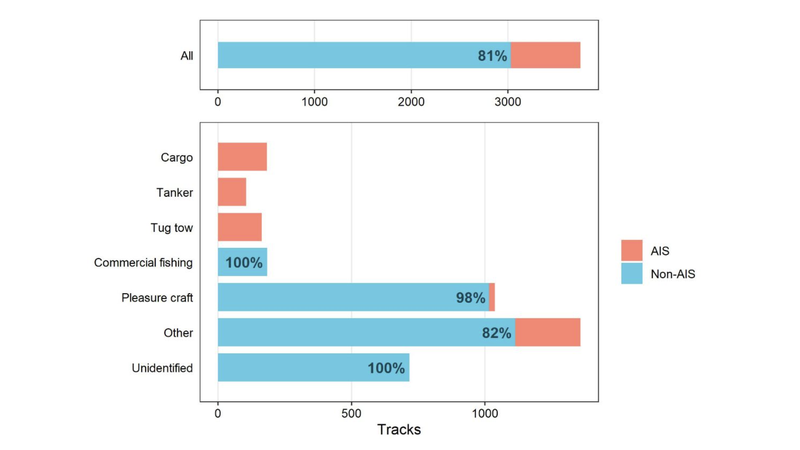
Image source: Rodriguez et al. 2026, “Using a shore-based radar system to improve whale-vessel strike risk assessments at the entrance to San Francisco Bay,” published in Frontiers in Mammal Science under a CC BY 4.0 license
When researchers analyzed the movements of these smaller vessels, they found interesting patterns that would also be absent in traditional datasets. Smaller vessel activity surged dramatically during the summer, peaking at an estimated 232 visits in a single day, while the presence of larger commercial vessels remained consistent throughout the year. The smaller vessels also traveled faster and had higher rates of acceleration and deceleration. Notably, these vessels did not significantly lower their speeds when conditions were foggy and whales would be less visible at the surface.
Why does that matter for whales?
Many factors contribute to whale-vessel strike risk, and assessments in the San Francisco Bay Area require researchers and managers to consider vessel activity alongside local species presence, behavior, among other factors. M2 is a valuable tool for providing robust data on the full spectrum of vessels using this dynamic, highly urbanized waterway. By capturing vessel activity that may otherwise go unrecorded, M2 can help ensure that whale-vessel strike risk assessments are based on the most comprehensive possible picture of vessel traffic.
Read the full article here:
https://www.frontiersin.org/journals/mammal-science/articles/10.3389/fmamm.2026.1888831