M2 Blog: We Have Radar Data, Now What?

M2 Blog: We Have Radar Data, Now What?
Posted by Peter Liu, M2 Data Science Intern
January 15, 2026
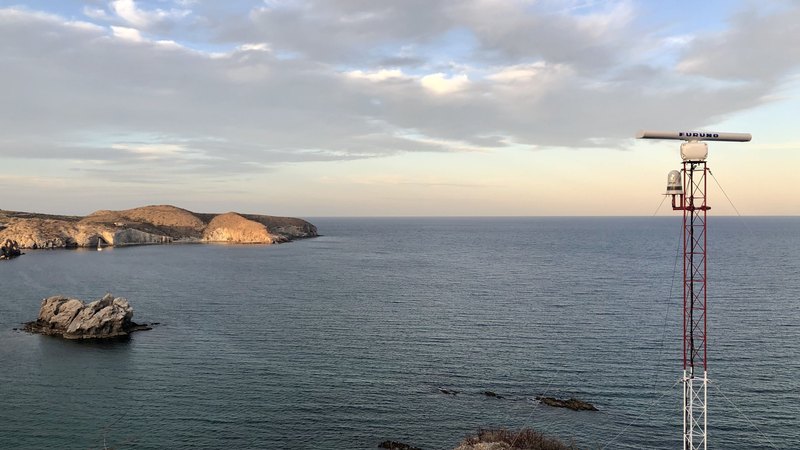
Marine Monitor (M2) systems around the world have collected millions of potential vessel tracks across dozens of sites. In order to filter out the radar noise (occasionally waves, rain, or birds pass through the detected region and are falsely registered as tracks), the M2 team developed an accurate confidence model identifying whether a track truly belongs to a vessel. We’re now expanding this system with a staged machine learning pipeline to also characterize activity patterns, helping support strategic decision making.
For law enforcement and marine conservation agencies, having real-time insights into vessel activities around marine protected areas (MPAs) is critical: distinguishing whether a vessel is simply passing through, stopping briefly, or actively fishing in MPAs can make the difference between ignoring typical behavior and preventing illegal activity.
A Two-Stage Machine Learning Pipeline – Patent Pending
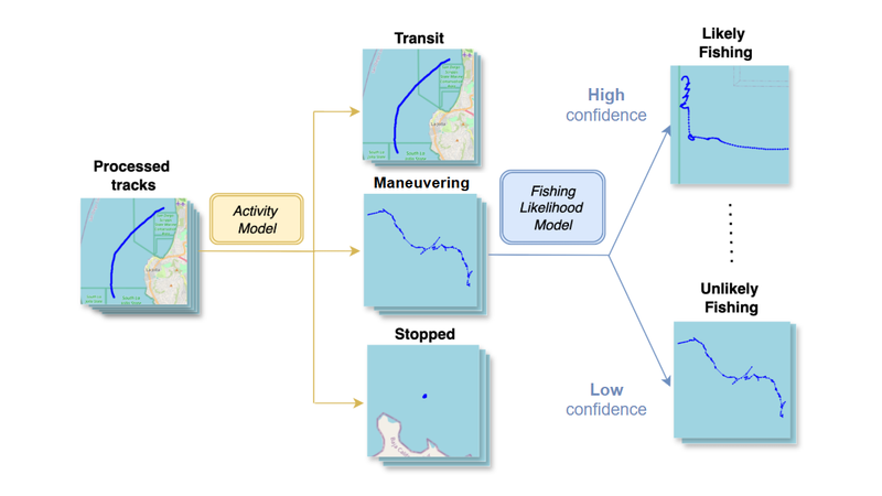
Stage 1 – Activity Model
Every vessel track is first classified into one of three activity types:
- Transit – moving straight or along a coastline
- Stopped – anchored or moored
- Maneuvering – everything else, where tracks usually exhibit curves, looping or other unique patterns
This first stage classification is designed to distinguish between vessel type and its current activity. For example, a commercial fishing boat may not be of interest if it’s just passing through an MPA.
Stage 2 – Fishing Likelihood Model
For all tracks in the “maneuvering” category, we apply a second model that assigns a fishing likelihood score between 0% to 100%. In this way, users can choose how to use the score to identify potential fishing activities instead of using a model that strictly classifies tracks into fishing or not.
In Development
For potential fishing activities, we are also working on a real-time inference algorithm to determine the current activity at each point of vessel detection! This provides users with valuable insights into what the vessel is doing at the moment.
Model Output Demo
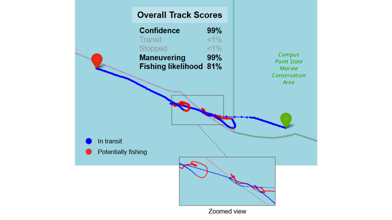
To illustrate our model’s utility, we demonstrate the model prediction results (below) on a vessel observed near the M2 site at Coal Oil Point near Santa Barbara, CA. As expected, our model classified it into the ‘maneuvering’ tracks category and assigned a rather high fishing likelihood score of 81%. Additionally, our detection-point level model was able to parse the track into transiting through the Campus Point State Marine Conservation Area, and then potentially fishing just outside of the MPA.
An New Era of Marine Monitoring with the M2 System
Our newly designed pipeline will allow M2 users to proactively monitor vessel behavior as it unfolds, significantly expanding how users can engage with the M2 platform. We have begun testing and will keep users updated as the work continues!